
Great Hikes in the Smokies
Sightseeing
Chimney Tops Trail is a 3.6 mile heavily trafficked out and back trail located near Gatlinburg, Tennessee that features a river and is rated as difficult. The trail is primarily used for hiking and is best used from March until November.
24 íbúar mæla með
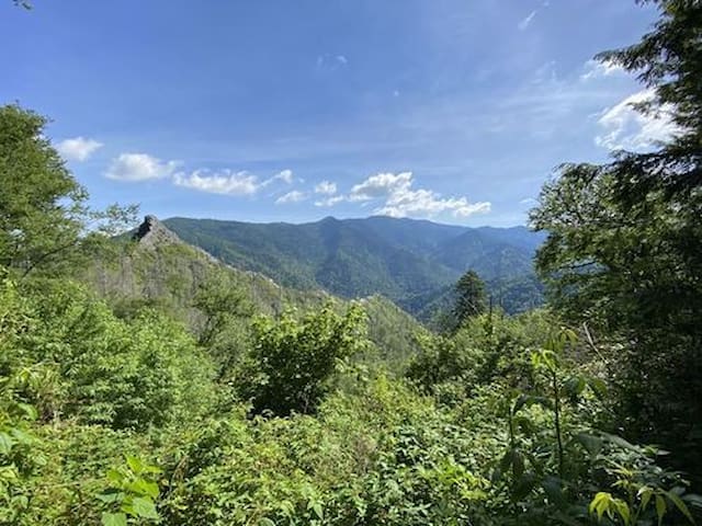
Chimney Tops Trail
Chimney Tops Trail is a 3.6 mile heavily trafficked out and back trail located near Gatlinburg, Tennessee that features a river and is rated as difficult. The trail is primarily used for hiking and is best used from March until November.
Alum Cave Trail to Mount LeConte is a 10.9 mile heavily trafficked out and back trail located near Gatlinburg, Tennessee that features a waterfall and is rated as difficult. The trail is primarily used for hiking and backpacking and is best used from April until November.
56 íbúar mæla með
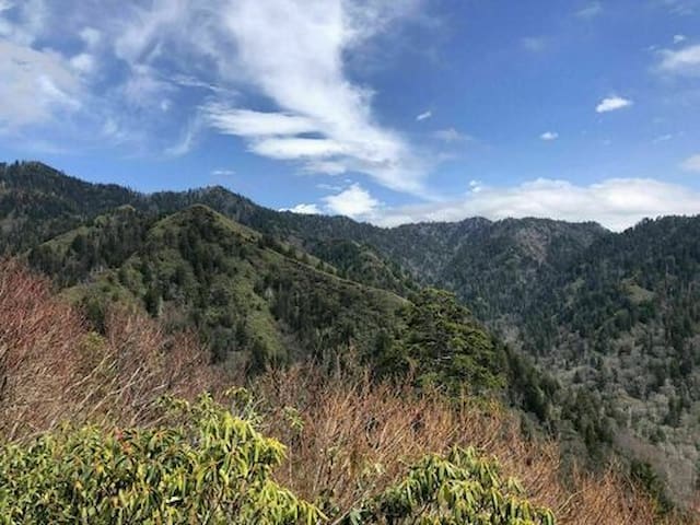
Alum Cave Trail
Alum Cave TrailAlum Cave Trail to Mount LeConte is a 10.9 mile heavily trafficked out and back trail located near Gatlinburg, Tennessee that features a waterfall and is rated as difficult. The trail is primarily used for hiking and backpacking and is best used from April until November.
Trillium Gap Trail to Grotto Falls is a 6.8 mile heavily trafficked out and back trail located near Gatlinburg, Tennessee that features a waterfall and is rated as moderate. The trail is primarily used for hiking and is accessible year-round.
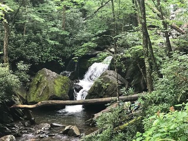
Trillium Gap Trail
Trillium Gap TrailTrillium Gap Trail to Grotto Falls is a 6.8 mile heavily trafficked out and back trail located near Gatlinburg, Tennessee that features a waterfall and is rated as moderate. The trail is primarily used for hiking and is accessible year-round.
We clocked this hike at 6.5 miles and 1,700 feet of elevation. This is classified as a moderately challenging trail but we did it in the snow and ice which definitely made it more challenging. This is a busy out and back trail with limited parking so would suggest an early morning start for both parking and less trail traffic.
59 íbúar mæla með
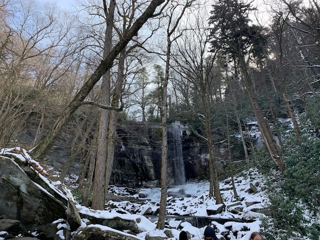
Rainbow Falls Trail
Rainbow Falls TrailWe clocked this hike at 6.5 miles and 1,700 feet of elevation. This is classified as a moderately challenging trail but we did it in the snow and ice which definitely made it more challenging. This is a busy out and back trail with limited parking so would suggest an early morning start for both parking and less trail traffic.